- Client – Antragrafik Systems Sdn. Bhd.
- Project Duration – 3 months
- Delivery – GIS Web Application
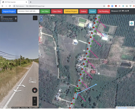
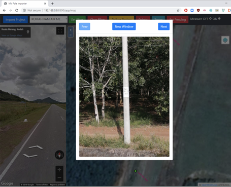
As part of the previous project “To collect TNB 33 kV and 11 kV Medium Voltage (MV) Poles between substations in Kedah, Perak and Perlis using handheld GPS”, a centralized GIS system was need to do the post-processing, validation, monitoring and automating the delivery process. Using opensource GIS technologies like Geoserver, PostgresSQL DB, gdal python libraries, the web application was built to migrate the field collected data and cross validate using Google Street View API which was also integrated in the web application.
The web application speed up the delivery of data by 3x than the manual process and were able to complete over 150,000 poles in 3 months.
The web application will also auto quality check the pole is within the 0.5 m from the road distance.